Our Services
At W.D. Roth Land Surveyors, we offer a comprehensive range of professional land surveying services tailored to meet the unique needs of each client.
From cadastral surveys to engineering projects, our expertise and advanced technology ensure precise and reliable results. Explore our services and discover how we can support your next project.
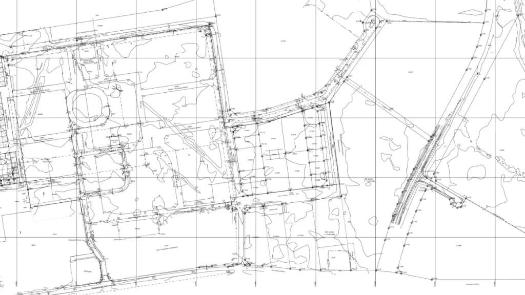
Cadastral Surveys
Defining Property Boundaries with Precision
We offer accurate and reliable cadastral surveys for legal property boundaries, land subdivision, and ownership verification. Essential for establishing or confirming land ownership, our surveys provide the official documentation needed for smooth transactions and development planning.
Our expertise spans projects such as the Eye of Africa Private Golf Estate and the industrial township for Heineken Brewery, ensuring precise results for even the largest developments.
Sectional Title Surveys
At W.D. Roth Land Surveyors, we provide comprehensive sectional title surveys, tailored to the unique requirements of property developers, homeowners, and commercial clients. A sectional title survey is essential when dividing a building or development into individual ownership sections, such as apartments, townhouses, or office units. These surveys not only determine the boundaries of each unit but also define the common property areas, ensuring accurate legal documentation and compliance with local regulations.
We’ve successfully completed over 20,000 sectional title unit surveys, partnering with numerous developers across South Africa. Our detailed approach ensures that every aspect of your development is correctly documented, allowing for efficient property registration, management, and future sales.
Our use of advanced surveying technology guarantees the precision needed to facilitate smooth transactions and legal processes. By partnering with W.D. Roth Land Surveyors, you can be confident that your sectional title projects are in expert hands, from the initial layout to the final registration.
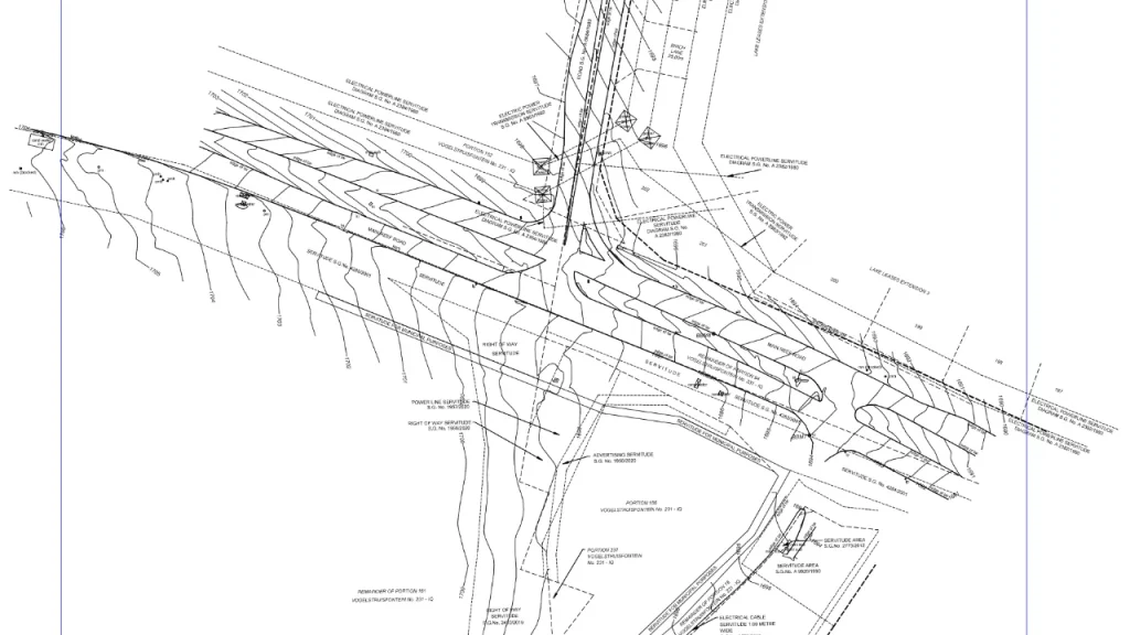
Engineering Surveys
At W.D. Roth Land Surveyors, we provide engineering surveys that deliver the detailed data needed for the planning, design, and construction of infrastructure and development projects. From topographical mapping to precise layouts, our surveys support everything from roads and buildings to power lines and large-scale developments. With a commitment to accuracy, we ensure that each phase of your project is based on reliable, high-quality information.
Our experience spans major projects such as “The Glen” shopping centre, the Pennyville to Fleurhof 11kV power line, and the Heineken Brewery industrial township. Using advanced surveying technology and CAD software, we deliver precise plans that meet industry standards, ensuring seamless collaboration with engineers and contractors for successful project outcomes.
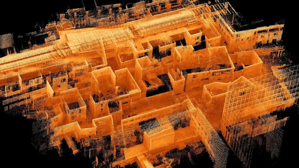
Terrestrial LiDAR Scanning
High-Precision 3D Mapping for Complex Environments
At W.D. Roth Land Surveyors, we offer cutting-edge terrestrial LiDAR scanning services, providing high-resolution 3D mapping and spatial data for a wide range of projects. Using advanced laser scanning technology, we capture millions of data points with pinpoint accuracy, allowing us to create detailed digital models of structures, landscapes, and complex environments. Whether for construction, infrastructure, or topographical analysis, our LiDAR scanning ensures precise measurements and in-depth insights for more informed decision-making.
With this technology, we offer our clients the ability to visualize and assess their project sites in remarkable detail. This data is not only used for design and construction, but also for ensuring compliance with industry regulations and reducing risks. By utilizing LiDAR, we help streamline decision-making, reduce project delays, and optimize overall project management.
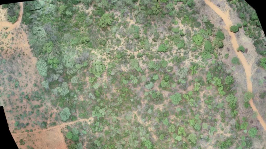
Drone Mapping
At W.D. Roth Land Surveyors, we harness the power of drone mapping technology to deliver accurate and efficient aerial surveys for a variety of projects. Utilizing state-of-the-art drones equipped with high-resolution cameras and sensors, we capture detailed aerial imagery and topographical data quickly and safely. Drone mapping is ideal for large-scale site assessments, construction monitoring, and environmental analysis, allowing us to gather extensive data while minimizing disruption to the surrounding area.
Our drone mapping services provide clients with comprehensive insights through 2D and 3D models, orthomosaic maps, and digital surface models. This technology enhances traditional surveying methods by enabling faster data collection and real-time analysis, ensuring that you have the information you need to make informed decisions. Whether you’re planning a new development, conducting an environmental study, or managing an ongoing project, our drone mapping solutions deliver precision, efficiency, and valuable insights that drive project success.